100% Online
Complete your Penn State course work at your own pace and 100% online.
Application deadline
Credits and costs
10-Week Terms
Finish your program faster with accelerated 10-week terms.
Gain Geospatial Skills in Remote Sensing and Earth Observation
Work with remotely sensed imagery and terrain models.
Use computational methods to automate the spatial analysis of earth observation data and integrate those skills into a GIS workflow.
Collect data and analyze images to provide spatial insights for improved decision-making in business, crisis management, natural resources and energy, urban planning, and public safety.
Prepare to sit for the GISP, ASPRS, and/or USGIF certification exams.
Start or Advance Your Career

Start or Advance Your Career
You can use the knowledge gained from this program and the support of Penn State career resources to pursue careers in a variety of fields, depending on your goals.

Ready to Learn More?
Get the resources you need to make informed decisions about your education. Request information on this program and other programs of interest by completing this form.
A Head Start toward a Master’s Degree

A Head Start toward a Master’s Degree
Not only can this program help create opportunities in your career, it can also give you a solid head start toward a full master’s degree.
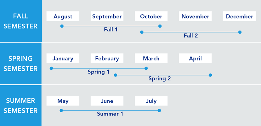
Earn Your Certificate in One Year
Whether you are looking to finish your program as quickly as possible or balance your studies with your busy life, Penn State World Campus can help you achieve your education goals. Many students take one or two courses per semester.
A Trusted Leader in Online Education

Penn State has a history of more than 100 years of distance education, and World Campus has been a leader in online learning for more than two decades. Our online learning environment offers the same quality education that our students experience on campus.
Information for Military and Veterans

Are you a member of the military, a veteran, or a military spouse? Please visit our military website for additional information regarding financial aid, transfer credits, and application instructions.
How to Apply to Penn State

How to Apply to Penn State
Apply by August 1 to start August 13
Contact Us

Contact Us
Have questions or want more information? We're happy to talk.