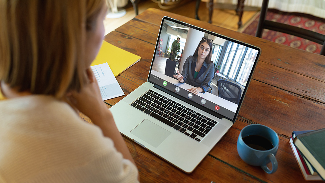
Overhead view of a geodesign project

Master of Professional Studies inGeodesign

Program summary

This online geodesign program is designed to provide maximum flexibility while preparing students to address complex environmental design problems. Structure your courses to accommodate your schedule or to complete your degree as quickly as possible.

Application deadline

Apply by April 1 to start May 6

Credits and costs

35 Credits$1,017 per credit

Online graduate education in Geodesign at Penn State

Prepare to take leadership roles in addressing complex environmental design problems in settings ranging from urban design to conservation planning, with the 35-credit Master of Professional Studies in Geodesign from Penn State World Campus. As a student in our geodesign program, you can learn to capitalize on the power of spatial knowledge and evolving technologies, identify opportunities that emerge to better inform the design, understand your relevance to particular situations, and assist communities in designing alternative futures based on a unique process that brings all this information into focus.

Geodesign at Penn State

The World Campus graduate geodesign program is offered in partnership with Penn State's College of Arts and Architecture and in cooperation with Penn State's Department of Geography. The program is taught by expert faculty practicing at Penn State and in the field and features in-depth study in geodesign and geography courses to provide you with a comprehensive knowledge of the field that can prove highly attractive to potential employers.

Geodesign Program Flexibility

Geodesign (GEODZ) courses operate on 8-week terms. Our geography (GEOG) courses operate on 10-week terms. With two course terms offered in the fall and spring and one in the summer, some courses may overlap. However, this term structure provides you with the greatest flexibility possible in completing your master's degree at your preferred pace. You can choose to schedule your courses without any overlap, or take as many courses as possible to finish sooner.

Courses

The overall objective of the 35-credit online MPS in Geodesign program is to help you gain the knowledge and skills to:

  • lead the design of sites, developments, and regions to achieve ecological sustainability, economic viability, and social relevancy, by applying appropriate geodesign processes
  • develop successful geoprocessing workflows to analyze and assess building and development impacts on the natural and cultural environment
  • recognize the combined power of design- and science-based analysis and solution synthesis to ascertain opportunities for managing resources successfully, anticipating change, and imagining alternative futures
  • achieve the advanced collaboration skills needed for creating multidisciplinary teams to develop geospatial models for development and conservation

Program Flexibility

All geodesign (GEODZ) courses operate on 8-week terms except for our studio courses. The studio courses will run for the full 14-week semester. Our geography (GEOG) courses operate on 10-week terms. Two course terms will be offered in the fall and spring and one in the summer. With two sessions being offered in fall and spring, and one session in the summer, some courses may overlap. However, this term structure provides you with the greatest flexibility possible in completing your degree at your preferred pace. You can choose to schedule your courses without any overlap, or take as many courses as possible to finish sooner.

Required Courses (21 credits)

  • 3
    credits

    Students study the theory and principles of geospatially based design by investigating the methods and collaborative nature of the geodesign process.

    • Prerequisite

      GEOG 482 (Please contact the program to discuss waiving this requirement.)

  • 3
    credits

    The principles, inherent values, and practical applications of evaluation and decision models as implemented within the geodesign framework.

    • Prerequisite

      GEODZ 511

    • 3
      credits

      The principles, inherent values, and practical applications of process and impact models as implemented within the geodesign framework.

      • Prerequisite

        GEODZ 822

    • or:
      3
      credits

      The principles, inherent values, and practical applications of representation and change models as implemented within the geodesign framework.

      • Prerequisite

        GEODZ 822

  • 3
    credits

    Problems-based workshop where students apply geodesign process, in a collaborative setting, to regional-scale landscape change and land planning topics.

    • Prerequisite

      GEODZ 824 or GEODZ 826

  • 6
    credits

    Problems-based workshop where students apply geodesign process, in a collaborative setting, to urban-scale landscape change and land planning topics.

    • Prerequisite

      GEODZ 842

Geography Elective Courses

You are required to take at least 8 credits of geography courses at the 400 level or higher. Based on your experience in geographic information systems, you and your academic adviser will determine which GEOG electives will best meet your needs and interests. GEOG 482 and 483 are recommended for those individuals without GIS experience. View all GEOG electives available through World Campus.

Culminating Capstone Experience (6 credits)

  • 3
    credits

    Preparation and peer-review presentation of proposal for an individual capstone geodesign project.

    • Prerequisite

      GEODZ 852

  • 3
    credits

    Preparation and dissemination of geodesign capstone project results in a formal professional venue.

    • Prerequisite

      GEODZ 596A

Course Availability

If you're ready to see when your courses will be offered, visit our public LionPATH course search (opens in new window) to start planning ahead.

Costs and Financial Aid

Graduate Tuition

Graduate tuition is calculated based on the number of credits for which you register. Tuition is due shortly after each semester begins and rates are assessed every semester of enrollment.

2023–24 Academic Year Rates

Tuition rates for the fall 2023, spring 2024, and summer 2024 semesters.

How many credits do you plan to take per semester?Cost
11 or fewer$1,017 per credit
12 or more$12,203 per semester

2024–25 Academic Year Rates

Tuition rates for the fall 2024, spring 2025, and summer 2025 semesters.

How many credits do you plan to take per semester?Cost
11 or fewer$1,027 per credit
12 or more$12,325 per semester

Financial Aid and Military Benefits

Some students may qualify for financial aid. Take the time to research financial aid, scholarships, and payment options as you prepare to apply. Military service members, veterans, and their spouses or dependents should explore these potential military education benefits and financial aid opportunities, as well.

How to Apply

Deadlines and Important Dates

Admissions decisions are based on the quality of the applicant's credentials. A portfolio will be developed for an assessment of each applicant to the program. Your application will not be reviewed until all of your portfolio items have been submitted.

The application deadlines for this program are:

  • Summer Deadline:  Apply by April 1 to start May 6
  • Fall Deadline:  Apply by July 10 to start August 12
  • Spring Deadline:  Apply by October 10 to start January 13

The above start dates reflect the earliest possible date that a course may begin for that semester. Most Geodesign courses are 8 weeks in length, allowing students to schedule more than one course per semester. Geodesign course start dates vary.

Admissions Help

If you have questions about the admissions process, contact our admissions counselors.

Admission Requirements 

For admission to the Graduate School, an applicant must hold either (1) a baccalaureate degree from a regionally accredited U.S. institution or (2) a tertiary (postsecondary) degree that is deemed comparable to a four-year bachelor's degree from a regionally accredited U.S. institution. This degree must be from an officially recognized degree-granting institution in the country in which it operates.

What You Need

Applications are submitted electronically and include a nonrefundable application fee. You will need to upload the following items as part of your application:

Official transcripts from each institution attended, regardless of the number of credits or semesters completed. Transcripts not in English must be accompanied by a certified translation. Penn State alumni do not need to request transcripts for credits earned at Penn State, but must list Penn State as part of your academic history. If you are admitted, you will be asked to send an additional official transcript. You will receive instructions at that time.

GPA and Test Scores —GRE or GMAT scores are NOT required for admission.

English Proficiency — The language of instruction at Penn State is English. With some exceptions, international applicants must take and submit scores for the Test of English as a Foreign Language (TOEFL) or International English Language Testing System (IELTS). Minimum test scores and exceptions are found in the English Proficiency section on the Graduate School's "Requirements for Graduate Admission" page. Visit the TOEFL website for testing information. Penn State's institutional code is 2660.

References (3) — you will need to initiate the process through the online application by entering names, email addresses, and mailing addresses of three references. Upon submission of your application, an email will be sent to each reference requesting they complete a brief online recommendation regarding your commitment for success in an online program. Please inform all recommenders they must submit the form in order for your application to be complete.  

Program-Specific Questions/Materials

Résumé — Upload your résumé to the online application.

Statement of Purpose — Your personal statement should not exceed three single-spaced pages. It should describe your specific career goals and objectives, prior experience relevant to the decision to pursue an advanced degree, and other information that may be useful to the admissions committee. The statement should also include an overview of a possible topic for the individual capstone project.

Start Your Application

You can begin your online application at any time. Your progress within the online application system will be saved as you go, allowing you to return at any point as you gather additional information and required materials.

Begin the graduate school application

  • Choose Enrollment Type: "Degree Admission"
  • Choose "WORLD CAMPUS" as the campus

Checking Your Status

You can check the status of your application by using the same login information established for the online application form.

Technical Requirements 

Review the technical requirements for this degree program.

Ready to Learn More?

Get the resources you need to make informed decisions about your education. Request information on this program and other programs of interest by completing this form.

* required1/3

I agree to be contacted via phone, email, and text by Penn State World Campus and affiliates. I understand my information may also be shared with select providers to offer ads that may be of interest to me.Privacy Policy. reCAPTCHA protected. Google Privacy Policy and Terms of Service.

Learn more about this program

Download Program Brochure All my programs

Ready to take the next step toward your Penn State master's degree?

Apply by April 1 to start May 6. How to Apply 

Start or Advance Your Career

Example of a map produced by geospatial professionals

You can use the knowledge gained from this program and the support of Penn State career resources to pursue careers in a variety of fields, depending on your goals.


Job Titles Related to This Degree

The following roles are often held by people with this type of degree:

  • Green Building Design Specialist
  • Sustainable Communities Designer
  • Sustainable Design Consultant
  • Urban Design Consultant

Employment Outlook for Occupational Fields Related to This Degree

Estimates of employment growth and total employment are provided by the U.S. Bureau of Labor Statistics and are subject to change. While these occupations are often pursued by graduates with this degree, individual outcomes may vary depending on a variety of factors. Penn State World Campus cannot guarantee employment in a given occupation.

Architects, Except Landscape and Naval

4.8%
employment growth (10 years)
107,490
total employment

Urban and Regional Planners

3.7%
employment growth (10 years)
39,880
total employment

Career Services to Set You Up for Success

Student having a virtual meeting on a laptop with a career counselor

From the day you're accepted as a student, you can access resources and tools provided by Penn State World Campus Career Services to further your career. These resources are beneficial whether you're searching for a job or advancing in an established career.

  • Opportunities to connect with employers
  • Career counselor/coach support
  • Occupation and salary information
  • Internships
  • Graduate school resources 

Contact Us

To learn more about the Master of Professional Studies in Geodesign, offered in partnership with the College of Arts and Architecture, please contact:

World Campus Admissions Counselors
Phone: 814-863-5386
[email protected]

Online Geodesign Program Contact:

David Goldberg, Associate Clinical Professor and Program Director
Geodesign Program Office
College of Arts and Architecture
121 Stuckeman Family Building
University Park, PA 16802-6500
Phone: 814-865-6112
Fax: 814-863-8706
[email protected]

To learn more about the program, visit the program website within Penn State's College of Arts and Architecture.

Faculty

  • Janet Silbernagel Balster

    • Degree
      Ph.D., Forest Science, Michigan Technological University
    • Degree
      M.S., Forest Science, Michigan Technological University
    • Degree
      B.L.A., Landscape Architecture, University of Wisconsin-Madison

    Dr. Janet Silbernagel Balster is an adjunct lecturer teaching GEODZ 826: Representation and Change. Janet brings a wealth of practical knowledge and expertise, having worked as a landscape ecologist and landscape architect with the U.S. Forest Service before beginning an academic career that spans more than 25 years. Janet is an emeritus professor of landscape architecture at the University of Wisconsin-Madison. Janet founded Silvernail Studio for Geodesign, LLC. The private practice offers multifaceted services that span professional geographic information system (GIS) map products to landscape conservation strategies and sustainable landscape architectural design.

  • Kelleann Foster

    • Degree
      M.L.A., Landscape Architecture and Regional Planning, University of Massachusetts
    • Degree
      B.S.L.A., Landscape Architecture, Penn State

    Kelleann Foster is an active emeritus professor of landscape architecture. She is a proven design leader and invited speaker at many national and international design planning and technology-focused conferences. She is a registered landscape architect whose work is rooted in interdisciplinary and forward-thinking outreach in many respects. Her work advances technologies to communicate alternative scenarios to citizens. She is the author of the Wiley book Becoming a Landscape Architect: A Guide to Careers in Design.

  • David Goldberg

    • Degree
      M.L.A., Landscape Architecture, Penn State
    • Degree
      B.S.L.A., Landscape Architecture, Penn State

    David Goldberg is the director of online geodesign programs and associate clinical professor of landscape architecture. David teaches courses in design implementation, building information modeling, site design, and geodesign. His research intentionally sways between tool-centric and topic-centric inquiries, allowing him to be pragmatic in professional practice and aspirational in teaching. He negotiates the role of applied design computing between the academy and the industry. This includes optimizing the physical and virtual environments where teams interact, enhancing interdisciplinary and transdisciplinary collaborations, and developing strategies for virtual learning environments for studio design courses. Topically, he focuses on how landscape architecture incorporates building information modeling and how leveraging big data and near-real-time data creates "digital twins" for landscape architecture — the results of which will be impactful to the practice and discourse of geodesign.

  • Devin Lavigne

    Degree
    B.A.A., Urban and Regional Planning, Ryerson Polytechnic University

    Devin Lavigne is an adjunct lecturer teaching GEODZ 852: Urban/District-Scale Challenges. Devin is a nationally recognized urban planning professional with more than 20 years of experience in urban planning, geodesign, and geographic information systems (GIS). Lavigne is a co-founder of Houseal Lavigne Associates, an award-winning planning and design firm based in Chicago. The firm specializes in community planning, urban design, and economic development, and uses creativity and collaboration to deliver quality solutions.

  • James Sipes

    • Degree
      M.L.A., Landscape Architecture, Iowa State University
    • Degree
      B.L.A., Landscape Architecture, University of Kentucky

    James Sipes is an award-winning environmental planner, landscape architect, and writer with more than 30 years of experience encompassing a wide range of design and planning projects. His work includes environmental planning and design, land use planning, watershed management, low-impact development, urban design, cultural resource management, and community-based design. He has received national recognition, having written more than 350 articles for a variety of publications and several books on environmental issues, green infrastructure, and water resources.

  • Robert Stauder

    • Degree
      MPS, Community Planning, University of Cincinnati
    • Degree
      B.A., Spanish, Colorado State University

    Robert Stauder is an adjunct lecturer teaching GEODZ 511: Geodesign History, Theory, and Principles. Robert is a geographic information systems (GIS) professional with more than 25 years of experience in geodesign, GIS analysis, and planning. Robert is the GIS analyst/developer for Houseal Lavigne, an award-winning planning and design firm based in Chicago. Prior to joining Houseal Lavigne, Robert was a project manager for Esri, where he worked on and supported projects in the United States, Europe, Africa, and Asia. Robert has experience in using GIS for public engagement, planning, conservation, public safety, and workflow optimization.

News

We Are Sculpture at Penn State's University Park campus
Geodesign program launches video series to raise awareness about the discipline, Penn State College of Arts and Architecture

Ready to take the next step toward your Penn State master's degree?

Apply by April 1 to start May 6. How to Apply