Application deadline
Credits and costs
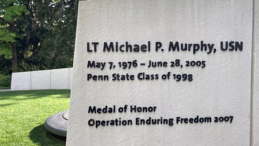
Earn a Graduate Degree in Homeland Security – Intelligence and Geospatial Analysis Option
The best intelligence resource is an educated analyst. The Intelligence and Geospatial Analysis option within the Master of Professional Studies (MPS) in Homeland Security, offered in partnership withPenn State College of Earth and Mineral Sciences' Online Geospatial Education, is designed to increase the skills and knowledge of the analyst to produce accurate intelligence to help save lives, improve government, and assist businesses. Intelligence is applied in such law enforcement, homeland security, emergency management, and business applications as:
- investigating organized crime and serial criminal activity
- anticipating and preventing terrorist activities
- detecting and assessing threats from criminal and terrorist groups
- preparing for and responding to emergencies and disasters
- gaining a geographic advantage over an adversary
- securing critical infrastructure and key resources
The Penn State Difference
100% Online Course Work — The flexibility of studying when and where you want can give you the opportunity to gain new skills and knowledge while maintaining your current responsibilities.

Nationally Recognized and Accredited — Penn State's geospatial education program has been a trusted leader in online education since 1998. More than 7,000 professionals have turned to us to help them earn a respected credential online. We have strong industry connections and serve as supportive members of influential industry associations:
• United States Geospatial Intelligence Foundation (USGIF)
• International Association of Law Enforcement Intelligence Analysts (IALEIA)
• International Association for Intelligence Education (IAFIE)
• Defence Surveyor’s Association
Applicable Skill Set — We take a pragmatic, hands-on approach in the program. Our curriculum extends beyond theory so you gain relevant skills that you can apply immediately in the workplace.
Online Master's Degree Curriculum
While the three core courses will offer you a solid foundation in homeland security theory and implementation, the bulk of your course work will focus on developing the expertise and career-ready skills you need to improve the intelligence reports that inform mission-critical decisions. In this option, you will learn to:
- use space-time thinking, knowledge of human and physical geography, problem-solving techniques, and geographic information technologies to improve decision-making
- identify and assess potential threats, vulnerabilities, and consequences within a geospatial context
- evaluate scientific evidence and best practices to understand how criminals and terrorists behave spatially and improve real-world decisions
- apply leadership skills and principles to produce and act on information in a collaborative setting
- communicate the major issues of your discipline effectively to a diverse group
Who Should Apply?
The MPS in Homeland Security – Intelligence and Geospatial Analysis option is open to candidates who hold a bachelor's degree. The option is designed for the new or established working professional, with or without geographic information systems (GIS) experience, and is ideal for those working in federal agencies such as the National Geospatial-Intelligence Agency, Department of Homeland Security, Department of Defense Services, and the FBI. Professionals who work in corporate risk and intelligence divisions, as well as state and local Fusion Centers and law enforcement intelligence units, may also benefit from this degree. Members of the military are strongly encouraged to apply.
Accelerated Admission
Students who begin in one of our GIS, GEOINT, geospatial programming, or remote sensing certificate programs and who earn a 3.67 GPA or higher after completing the first three courses may be eligible for accelerated admission to the MPS in Homeland Security – Intelligence and Geospatial Analysis option program.
With the accelerated admission option, none of the following are required:
- GREs
- professional experience
- letters of recommendation
Learn more about how you may qualify for the accelerated admission option.
Information for Military and Veterans
Are you a member of the military, a veteran, or a military spouse? Please visit our military website for additional information regarding financial aid, transfer credits, or application instructions.
Online Education at Penn State
Penn State has a history of more than 100 years of distance education and more than a decade of experience in online learning. We create an online learning environment that offers you the same quality education our residential students experience in a face-to-face setting. Learn more about Penn State World Campus.
Courses
Courses in Penn State's 33-credit online Master of Professional Studies in Homeland Security – Intelligence and Geospatial Analysis option helps analysts develop knowledge and skills to disseminate accurate intelligence that may save lives, improve governments’ ability to prepare for and respond to disasters, and assist businesses.
All courses are asynchronous, meaning you are not required to log in at a particular time each week. You will have the flexibility to complete weekly assignments online at your preferred pace from anywhere in the world, while still having the opportunity to engage with Penn State faculty and program peers.
Courses designated with the GEOG prefix are delivered in one of five 10-week compressed semesters. Non-GEOG courses, however, typically follow a traditional semester schedule.
All students are required to complete the HLS Orientation (noncredit) as part of the HLS core curriculum before the end of their first semester. This orientation provides an overview of the HLS program and the field of homeland security.
Required Courses (9 credits)
Intelligence and Geospatial Analysis Option Prescribed Courses (12 credits)
Electives (select 9 credits)
All students are required to take at least one elective that is a 500-level course in addition to the Capstone Experience (GEOG 594) to satisfy the degree requirement of 6 credits at the 500 level.
Capstone Experience (3 credits)
Course Availability
If you're ready to see when your courses will be offered, visit our public LionPATH course search (opens in new window) to start planning ahead.
Costs and Financial Aid
Graduate Tuition
Graduate tuition is calculated based on the number of credits for which you register. Tuition is due shortly after each semester begins and rates are assessed every semester of enrollment.
| How many credits do you plan to take per semester? | Cost |
|---|---|
| 11 or fewer | $1,017 per credit |
| 12 or more | $12,203 per semester |
| How many credits do you plan to take per semester? | Cost |
|---|---|
| 11 or fewer | $1,027 per credit |
| 12 or more | $12,325 per semester |
Financial Aid and Military Benefits
Some students may qualify for financial aid. Take the time to research financial aid, scholarships, and payment options as you prepare to apply. Military service members, veterans, and their spouses or dependents should explore these potential military education benefits and financial aid opportunities, as well.
To view the detailed list of cost of attendance elements, select “World Campus” as the location on the tuition site.
How to Apply
Deadlines and Important Dates
Regular Admission Option:
Online courses associated with the Intelligence and Geospatial Analysis Option (GEOG) are organized around 10-week compressed semesters (terms). The last date for submitting an HLS Intel application for the next 10-week Intelligence and Geospatial Analysis course offering is:
July 1 to begin in the fall term
October 15 to begin in the spring term
March 1 to begin in the summer term
Your degree application, including receipt of all materials, must be received by the following deadlines to be considered complete. Please be sure to make your recommenders aware of the date their letter is due. If you would like to verify that we have all of your materials, feel free to contact the program office at[email protected].
Accelerated Admission Option:
- At least 4 weeks before the term in which you intend to start the program.
Admissions Help
Questions about applying? Contact the program office at [email protected]. We have experts available to guide you through the process.
Admission Requirements
For admission to the Graduate School, an applicant must hold either (1) a baccalaureate degree from a regionally accredited U.S. institution or (2) a tertiary (postsecondary) degree that is deemed comparable to a four-year bachelor's degree from a regionally accredited U.S. institution. This degree must be from an officially recognized degree-granting institution in the country in which it operates.
Accelerated Admission Option
You can qualify for accelerated admission to the MPS in Homeland Security – Intelligence and Geospatial Analysis program by earning a 3.67 GPA or above after completing your first three classes as a student in any of our online geospatial certificate programs. After completing your third certificate course, you must submit your résumé and a professional statement of purpose explaining your goals for obtaining the HLS degree to the admissions chairperson.
The chairperson will review your personal statement, verify you have met the GPA threshold, and then make a decision regarding your admission to the master's program. Admission is not based solely on GPA.
Admissions decisions will be made in this manner on a rolling basis year-round, but you must have your application completed and submitted for consideration at least 4 weeks before the term in which you intend to start the degree program. Please contact the academic home directly at [email protected] with any questions.
Regular admission is still available for those who do not wish to begin with a certificate program.
What You Need
Applications are submitted electronically and include a nonrefundable application fee. You will need to upload the following items as part of your application:
Official transcripts from each institution attended, regardless of the number of credits or semesters completed. Transcripts not in English must be accompanied by a certified translation. Penn State alumni do not need to request transcripts for credits earned at Penn State, but must list Penn State as part of your academic history. If you are admitted, you will be asked to send an additional official transcript. You will receive instructions at that time.
GRE scores are NOT required.
English Proficiency — The language of instruction at Penn State is English. With some exceptions, international applicants must take and submit scores for the Test of English as a Foreign Language (TOEFL) or International English Language Testing System (IELTS). Minimum test scores and exceptions are found in the English Proficiency section on the Graduate School's "Requirements for Graduate Admission" page. Visit the TOEFL website for testing information. Penn State's institutional code is 2660.
References (3) — You will need to initiate the process through the online application by entering names, email addresses, and mailing addresses of three references. Upon submission of your application, an email will be sent to each reference requesting they complete a brief online recommendation regarding your commitment for success in an online program. Please inform all recommenders they must submit the form in order for your application to be complete.
References should come from professional peers and/or managers and supervisors.
Program-Specific Questions/Materials
Résumé — Upload your résumé to the online application.
Statement of Purpose — A statement of no more than 500 words explaining to the admissions committee how your professional experience and goals relate to the program to which you are applying. Your statement could include aspects such as the following: your reasons for pursuing the degree, why you feel you are a good candidate for the program, and any information you would like the admissions committee to know about you personally and/or professionally.
Start Your Application
You can begin your online application at any time. Your progress within the online application system will be saved as you go, allowing you to return at any point as you gather additional information and required materials.
Begin the graduate school application
- Choose Enrollment Type: "Degree Admission"
- Choose "WORLD CAMPUS" as the campus
- Choose "HOMELAND SECURITY" as the major
- Choose “MASTER OF PROFESSIONAL STUDIES” as the degree
- Choose “INTELLIGENCE AND GEOSPATIAL ANALYSIS OPTION” as the option
Checking Your Status
You can check the status of your application by using the same login information established for the online application form.
Technical Requirements
Review the technical requirements for this program.
Ready to Learn More?
Get the resources you need to make informed decisions about your education. Request information on this program and other programs of interest by completing this form.
Start or Advance Your Career

Start or Advance Your Career
You can use the knowledge gained from this program and the support of Penn State career resources to pursue careers in a variety of fields, depending on your goals.

Earn a Valuable Credential along the Way

Earn a Valuable Credential along the Way
Show mastery of specific subjects before your degree is complete. Thanks to shared courses across programs, students can often earn a certificate along with their degree in less time than if they earned them separately.
Contact Us
The MPS in Homeland Security – Intelligence and Geospatial Analysis option is an intercollege program that consists of courses developed and delivered by expert faculty from the College of Earth and Mineral Sciences at the Penn State University Park campus as well as Penn State Harrisburg.
Our program specialists are available now to help you with your application and to answer any questions you have about our online geospatial programs. Please contact us with anything you wish to discuss.
Julene Santiago, Geospatial Portfolio Program Assistant
Penn State College of Earth and Mineral Sciences
[email protected]
Phone: 814-865-2557
To see more detailed information about the geospatial portfolio, visit the program website within Penn State's College of Earth and Mineral Sciences. You can also visit the Open Educational Resources website to preview some of the geospatial courses offered online by the Department of Geography.
For general questions about Penn State World Campus, please contact:
World Campus Admissions Counselors
Phone: 814-863-5386
[email protected]
Faculty
Anthony C. Robinson
- DegreePh.D., Geography, Penn State
- DegreeM.S., Geography, Penn State
- DegreeB.S., Applied Geography, East Carolina University
Dr. Anthony C. Robinson is an associate professor and director of online geospatial education at Penn State. He is also assistant director for the GeoVISTA Center. Dr. Robinson is a cartographer who designs and evaluates geovisualization tools to improve geographic information utility and usability. He has worked in epidemiology, crisis management, national security, and education domains to develop and evaluate new methods for visualizing spatial data.
Ryan Baxter
- DegreeM.S., Geography, Penn State
- DegreeB.A., Geography and Environmental Sciences, Northwestern University
Ryan Baxter advises students and teaches courses in topics including renewable energy, environmental applications of GIS, cloud and server GIS technologies, and introductory geographic information concepts. He is active in technical research projects involving spatial databases, online data discovery tools, interactive mapping applications, and cloud-based GIS services. He is also engaged in research investigating the spatial modeling of land use change, quantifying the amount of land available for bioenergy feedstocks, and assessing the suitability and productivity of energy crops.
James Detwiler
- DegreeM.S., Geography, University of Delaware
- DegreeB.S., Earth Science, Penn State
James Detwiler is in a 100% teaching appointment and specializes in GIS programming. He teaches GEOG 485: GIS Programming and Automation; GEOG 863: Web Application Development; and GEOG 868: Spatial Database Management. His research interests are in the areas of applied GIS and climatology.
Panagiotis Giannakis
- DegreePh.D., Geosciences, University of Arkansas
- DegreeM.S., Human Resource Management, Athens University of Economics & Business
Panagiotis Giannakis is an Assistant Teaching Professor in the Department of Geography and the Dutton e-Education Institute within the College of Earth & Mineral Sciences. He received his PhD from the University of Arkansas, where he also maintained a key role in the advancement of the Online Geospatial Certificate program. His research interests lie at the intersection of Economic Geography, Strategic Management, and Social Networks. More specifically, Panagiotis’ research focuses on the relationship between organizational and physical and/or social network space.
Beth King
- DegreeM.Ed., Adult Education, Penn State
- DegreeB.S., Geography, Penn State
Beth King is co-author and instructor of GEOG 483: Problem-Solving with GIS; GEOG 482: Making Maps that Matter with GIS; and GEOG 597G: Challenges in Global Geospatial Analytics. She is assistant program manager for Online Geospatial Education and maintains regular communication with students in the MGIS degree program to identify their questions and concerns. Previously, she worked as a GIS analyst for a private water/wastewater engineering firm, where she managed a wide range of GIS projects, from turnkey sanitary sewer conversion to 911 rural addressing.
Fritz Kessler
- DegreePh.D., Geography, University of Kansas
- DegreeM.S., Geography, Penn State
- DegreeB.S., Geography, Ohio University
Dr. Fritz Kessler's teaching interests include cartography, geographic visualization, map projections, spatial analysis, land surveying, geography of health, and statistics. His research interests include map projections, geographic visualization, history of cartography, and cognitive cartography.
Karen Schuckman
- DegreeM.S., Geographic Information Systems, Penn State
- DegreeB.A., Liberal Arts, Penn State
- DegreeB.S., Meteorology, Penn State
Karen Schuckman's teaching and research interests include applications of airborne and spaceborne remote sensing to topographic mapping, land-use/land-cover analysis, positional accuracy assessment of remotely sensed base map data products, and other geospatial applications.
Gregory Thomas
- DegreePh.D., Administration and Leadership Studies, Indiana University of Pennsylvania
- DegreeMPA, Penn State
- DegreeB.S., Criminal Justice, Shippensburg University of Pennsylvania
Dr. Gregory Thomas has experience developing intelligence for decision-makers, supervising the analytical process, and providing team guidance. He also has experience teaching intelligence and analytical techniques to college students as well as intelligence analysts and law enforcement personnel. He has developed operational intelligence to support criminal investigations and anti-terrorism activities, and has selected, trained, and supervised analysts in a criminal intelligence center. His teaching and research focus on geospatial intelligence analysis, homeland security, and criminal intelligence.
Michelle Zeiders
- DegreeM.S., Geoenvironmental Studies, Shippensburg University of Pennsylvania
- DegreeB.S., Public Administration, Shippensburg University of Pennsylvania
Michelle Zeiders teaches GEOG 483: Problem-Solving with GIS; GEOG 484: GIS Database Development; and GEOG 487: Environmental Applications of GIS. She has been teaching introductory and software-intensive GIS courses since 1998. Prior to joining the geospatial education program, she worked as a GIS programmer/instructor for the Penn State Population Research Institute, a GIS project manager/instructor for the Institute for Transportation Research and Education at North Carolina State University, a GIS project manager at a private civil engineering firm, and a GIS analyst at MapQuest.